We use cookies to ensure our site functions properly and to store limited information about your usage. You may give or withdraw consent at any time.To find out more, read our privacy policy and cookie policy.
Manage Cookies
A cookie is information stored on your computer by a website you visit. Cookies often store your settings for a website, such as your preferred language or location. This allows the site to present you with information customized to fit your needs. As per the GDPR law, companies need to get your explicit approval to collect your data. Some of these cookies are ‘strictly necessary’ to provide the basic functions of the website and can not be turned off, while others if present, have the option of being turned off. Learn more about our Privacy and Cookie policies. These can be managed also from our cookie policy page.
Strictly necessary cookies(always on):
Necessary for enabling core functionality. The website cannot function properly without these cookies. This cannot be turned off. e.g. Sign in, Language
Analytics cookies:
Analytical cookies help us to analyse user behaviour, mainly to see if the users are able to find and act on things that they are looking for. They allow us to recognise and count the number of visitors and to see how visitors move around our website when they are using it. Tools used: Google Analytics
Share Belle Aire Creek Diversion and Wetland Creation on FacebookShare Belle Aire Creek Diversion and Wetland Creation on X (formerly Twitter)Share Belle Aire Creek Diversion and Wetland Creation on LinkedinEmail Belle Aire Creek Diversion and Wetland Creation link
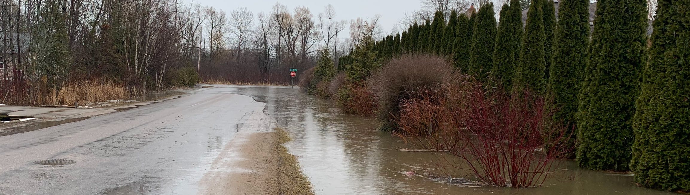
For many years, residents who live in the Belle Aire and Little Cedar Creek watersheds of south Alcona have had to manage the concerns associated with annual seasonal flooding. We know that this is frustrating and we’re working on improvements.
What is the Town doing to address issues associated with flooding?
Approximately 350 hectares bounded by 6th Line to the north;
Belle Aire Beach Road to the south;
The rail line to the west and the shoreline of Lake Simcoe to the east;
A small subdivision in the southeast corner north of Belle Aire Beach Road;
Low-density housing along the Lake Simcoe Waterfront, and
Approximately a dozen rural houses along the Study area limits.
A map of the study area has been provided below and attached under "Documents".
Proposed Solutions
When the EA was completed, the following two solutions were identified:
Preferred Conveyance Solution
Upgrade Belle Aire Creek Channel and Culverts Capacity to Convey 2-yr Storm. This would include the re-shaping and cleanout of about 670m of Belle Aire Creek through the existing community north of Belle Aire Beach Road. Culvert replacements and improvements have also been recommended at the intersections of Temple Avenue and Maple Road.
Preferred Storage Solution
By-Pass Flows Above 2-year Storm to Existing Wetland via New Green Infrastructure Bypass/ Storage Channel in 30m Buffer and Construct Earth Berms in 30m Buffer. The preferred storage/ by-pass solution includes a flow split for storms above the 2-year storm event directed into a green infrastructure bio-filtration channel located at the south edge of Little Cedar Creek Wetland, with berming to increase/ facilitate wetland storage for storage up to the 100-year storm event. The solution also includes a dual outlet system with most flows entering Little Cedar Creek and an emergency discharge through a high flow outlet on municipal property directed towards Maple Road and outlet to Lake Simcoe.
Anticipated Benefits
A list of anticipated benefits is provided below. Please note, as the detailed design progresses there is potential for these benefits to change:
Reduction in annualized flooding events. This may help mitigate the current annualized damages by up to 91%;
Water quality benefits including a net total phosphorous reduction to Lake Simcoe of approximately 10.3kg per year (assuming zero "treatment");
Enhance and maintain the natural characteristics of the tributary area;
Maximize erosion control; and
Integrated stormwater management and quantity control.
Implementing a Solution
In 2021, the Town secured an Engineering Consultant to provide a detailed design based on the preferred solutions. We’re also working on coordinating with area landowners to ensure that the preferred solutions can be implemented.
Stay in the Loop!
Please follow the project to ensure you remain up to date on the current status of the project and to participate in any public engagement events and activities.
For many years, residents who live in the Belle Aire and Little Cedar Creek watersheds of south Alcona have had to manage the concerns associated with annual seasonal flooding. We know that this is frustrating and we’re working on improvements.
What is the Town doing to address issues associated with flooding?
Approximately 350 hectares bounded by 6th Line to the north;
Belle Aire Beach Road to the south;
The rail line to the west and the shoreline of Lake Simcoe to the east;
A small subdivision in the southeast corner north of Belle Aire Beach Road;
Low-density housing along the Lake Simcoe Waterfront, and
Approximately a dozen rural houses along the Study area limits.
A map of the study area has been provided below and attached under "Documents".
Proposed Solutions
When the EA was completed, the following two solutions were identified:
Preferred Conveyance Solution
Upgrade Belle Aire Creek Channel and Culverts Capacity to Convey 2-yr Storm. This would include the re-shaping and cleanout of about 670m of Belle Aire Creek through the existing community north of Belle Aire Beach Road. Culvert replacements and improvements have also been recommended at the intersections of Temple Avenue and Maple Road.
Preferred Storage Solution
By-Pass Flows Above 2-year Storm to Existing Wetland via New Green Infrastructure Bypass/ Storage Channel in 30m Buffer and Construct Earth Berms in 30m Buffer. The preferred storage/ by-pass solution includes a flow split for storms above the 2-year storm event directed into a green infrastructure bio-filtration channel located at the south edge of Little Cedar Creek Wetland, with berming to increase/ facilitate wetland storage for storage up to the 100-year storm event. The solution also includes a dual outlet system with most flows entering Little Cedar Creek and an emergency discharge through a high flow outlet on municipal property directed towards Maple Road and outlet to Lake Simcoe.
Anticipated Benefits
A list of anticipated benefits is provided below. Please note, as the detailed design progresses there is potential for these benefits to change:
Reduction in annualized flooding events. This may help mitigate the current annualized damages by up to 91%;
Water quality benefits including a net total phosphorous reduction to Lake Simcoe of approximately 10.3kg per year (assuming zero "treatment");
Enhance and maintain the natural characteristics of the tributary area;
Maximize erosion control; and
Integrated stormwater management and quantity control.
Implementing a Solution
In 2021, the Town secured an Engineering Consultant to provide a detailed design based on the preferred solutions. We’re also working on coordinating with area landowners to ensure that the preferred solutions can be implemented.
Stay in the Loop!
Please follow the project to ensure you remain up to date on the current status of the project and to participate in any public engagement events and activities.
Do you have any comments or questions you would like to provide us about this project? Submit a comment or question to us and we will respond to you shortly!
Share What is happening with this project? I did request an update last week. Haven't got an answer. on FacebookShare What is happening with this project? I did request an update last week. Haven't got an answer. on X (formerly Twitter)Share What is happening with this project? I did request an update last week. Haven't got an answer. on LinkedinEmail What is happening with this project? I did request an update last week. Haven't got an answer. link
What is happening with this project? I did request an update last week. Haven't got an answer.
Marrianne
asked
4 months ago
The Town, in partnership with the Lake Simcoe Region Conservation Authority, and Greenland International Consulting Ltd. completed a Conservation Authority Class Environmental Assessment (EA) in the Belle Ewart area as part of the Belle Aire Creek Diversion and Wetland Creation Project. Design has commenced based on the preferred solutions in the EA. The preferred solutions in the EA involve works on private property, so the Town is working with landowners in the area to ensure the solutions can be implemented. While design is underway, further progress is needed on the design and coordination with the landowners before we can forecast a construction timeline.
Thank you.
Share Has there been any status updates on the construction completion of the Belle Aire Creek Diversion? If so, how many months are anticipated until the works are completed? on FacebookShare Has there been any status updates on the construction completion of the Belle Aire Creek Diversion? If so, how many months are anticipated until the works are completed? on X (formerly Twitter)Share Has there been any status updates on the construction completion of the Belle Aire Creek Diversion? If so, how many months are anticipated until the works are completed? on LinkedinEmail Has there been any status updates on the construction completion of the Belle Aire Creek Diversion? If so, how many months are anticipated until the works are completed? link
Has there been any status updates on the construction completion of the Belle Aire Creek Diversion? If so, how many months are anticipated until the works are completed?
Joseph
asked
over 1 year ago
The Town, in partnership with the Lake Simcoe Region Conservation Authority, and Greenland International Consulting Ltd. completed a Conservation Authority Class Environmental Assessment (EA) in the Belle Ewart area as part of the Belle Aire Creek Diversion and Wetland Creation Project. Design has commenced based on the preferred solutions in the EA. The preferred solutions in the EA involve works on private property, so the Town is working with landowners in the area to ensure the solutions can be implemented. While design is underway, further progress is needed on the design and coordination with the landowners before we can forecast a construction timeline.
Thank you.
Share Good Day. I at the Temple Avenue and Spruce Avenue. My backyard flooded completely 4 times this year. I would like to check in and see what the status is on the Belle Aire Creek Diversion and Wetland Creation plan? Please let me know.. on FacebookShare Good Day. I at the Temple Avenue and Spruce Avenue. My backyard flooded completely 4 times this year. I would like to check in and see what the status is on the Belle Aire Creek Diversion and Wetland Creation plan? Please let me know.. on X (formerly Twitter)Share Good Day. I at the Temple Avenue and Spruce Avenue. My backyard flooded completely 4 times this year. I would like to check in and see what the status is on the Belle Aire Creek Diversion and Wetland Creation plan? Please let me know.. on LinkedinEmail Good Day. I at the Temple Avenue and Spruce Avenue. My backyard flooded completely 4 times this year. I would like to check in and see what the status is on the Belle Aire Creek Diversion and Wetland Creation plan? Please let me know.. link
Good Day. I at the Temple Avenue and Spruce Avenue. My backyard flooded completely 4 times this year. I would like to check in and see what the status is on the Belle Aire Creek Diversion and Wetland Creation plan? Please let me know..
rbebeacu
asked
over 3 years ago
Good Day and Thank you for you Inquiry. The Belle Air Creek Diversion project is currently in the design phase and we are expecting construction to commence in 2024.